Intro
I’ve been wanting to organize my thoughts on this topic for a long time. Living in Japan now, I’ve learned some Japanese geography. This is an effort to solidify my understanding and formalize what I’ve learned. Feel free to comment or let me know if I’m misunderstanding anything.
Islands
Japan is a nation composed of thousands of islands. Its population is about 125 million (roughly 3x the population of California) yet California has ~12% more surface area. The vast majority of its inhabitants live on four main islands.
- Hokkaido
- Honshu (~80% of population)
- Kyushu
- Shikoku
Regions
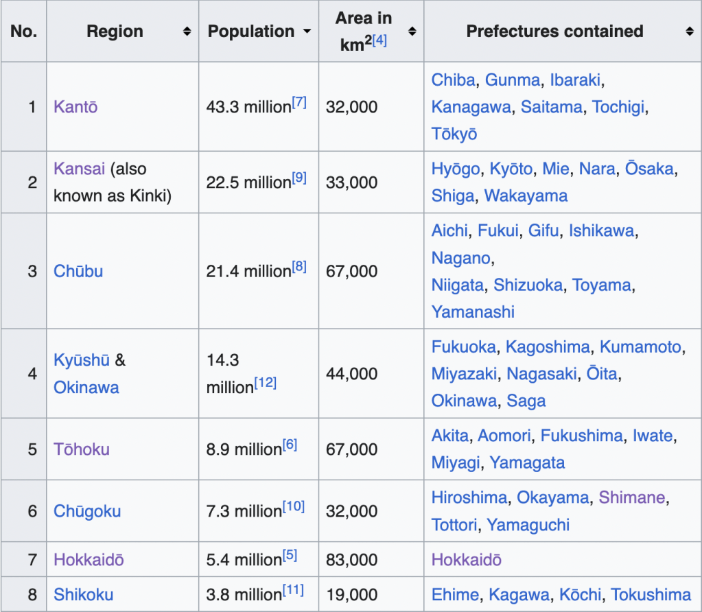
Within the islands, there are regions (AKA Chiho 地方).
- Hokkaido
- Hokkaido (both an island and its own prefecture)
- Honshu
- Tohoku (northern)
- Kanto (eastern)
- Chubu (central)
- Kansai AKA Kinki (south central)
- Chugoku (western)
- Kyushu
- Kyushu (both an island and its own prefecture)
- This region typically includes Ryugoku Islands/Okinawa
- Shikoku
- Shikoku (both an island and its own prefecture)
Prefectures
The regions are further divided into prefectures. There are 47, roughly akin to states in America. These are typically referred to as ken (県) with the exception of Tokyo (to AKA 都), Hokkaido (do AKA 道) as well as Osaka and Kyoto (fu AKA 府).
And More…
Of course I could go on and on with this idea. For example, cities in Japan such as Tokyo, Kyoto, Hiroshima, etc are further divided into wards. Shibuya-ku, Meguro-ku, etc and those have districts in them.
Sources
Thank you Wikipedia! Relevant links:

Leave a comment